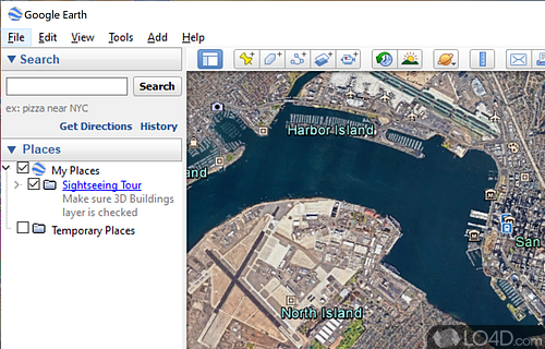
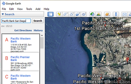
Search for and explore virtually any place on planet Earth with views of streets, terrain and satellite imagery in this amazing app with Street View and 3D architecture in some areas.
Google Earth is an amazing free software package that allows users to explore the world from the comfort of their own home. With features such as 3D imagery, satellite imagery, and a street view, you can virtually explore any place on Earth. The user interface is intuitive and easy to use with a simple menu of options and tools.
It's an innovative free program which basically allows users to zoom in and out of places across the planet, save certain countries like North Korea. In some cases, users can zoom in to just meters away from an objects.
The software allows you to explore the world with a range of tools, including GPS navigation and search filters. You can also use the 3D viewer to explore various areas in detail. It also includes a range of historical imagery, allowing you to explore how cities and landscapes have changed over the course of time.
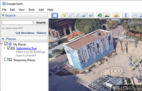
With the development and improvements that Google has made to this product, 3D environments are now available and you can zoom in to not only 3D terrains, but into 3D buildings in mainly large cities across the planet including the United States, the United Kingdom, South Africa and Canada, not to mention dozens more.
The application includes a library of what they call layers, which are different views which you can add to the application from landmarks to parks to regions and touristic destinations. Google Earth also provides news information as an addition to typical landmarks.
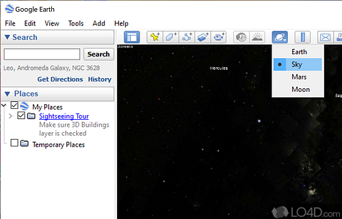
Every single new version that Google releases of Google Earth seems to include ever more interesting content and if you haven't checked it out lately, Google has actually added the Moon and Mars to its portfolio of interesting locations. Also interesting to look at is the historical imagery which has been added as of late.
Overall, an amazing application and a great way to spend a rainy day just exploring our planet.
Features of Google Earth
- 3D Buildings: Realistic representations of structures.
- Climate Data: Visualize weather patterns and conditions.
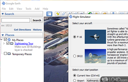
- Flight Simulator: Fly planes over detailed landscapes.
- GPS Tracking: Import and display GPS data.
- Historical Imagery: View past satellite images.
- KML Import: Share and create custom map layers.
- Mars and Moon: Experience extraterrestrial landscapes.
- Measurement Tools: Calculate distances and areas.
- Ocean Floor: Discover detailed underwater topography.
- Placemarks: Save and share points of interest.
- Satellite Imagery: High-resolution photos from space.
- Sky Mode: Explore stars, constellations and galaxies.
- Street View: Explore streets and neighborhoods in 3D.
- Tours: Guided multimedia explorations.
- User Community: Access content from other users.
Compatibility and License
Google Earth is provided under a freeware license on Windows from mapping with no restrictions on usage. Download and installation of this PC software is free and 7.3.6.10441 is the latest version last time we checked.
What version of Windows can Google Earth run on?
Google Earth can be used on a computer running Windows 11 or Windows 10. Previous versions of the OS shouldn't be a problem with Windows 8 and Windows 7 having been tested. It comes in both 32-bit and 64-bit downloads.
Other operating systems: The latest Google Earth version from 2026 is also available for Android, Mac and iPhone. These are often available from the app store.
Filed under:


